Tuesday, March 11, 2008

Off to the Expo! But Stop for Bunnies...


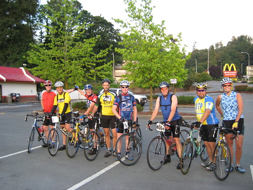
It's Sunday morning and we're heading to the Bike Expo! I switched our usual Saturday morning bike ride to Sunday due to a conflict I had this past weekend on Saturday. So following the 9 a.m. service, four of us--Ken, Johnny, Jeannette, and myself--met in the EFC Parking Lot, shared a brief devotional, prayed, and hit the road. The weather was in the low 50s with an overcast sky, but the rain stayed away all day for us. As we reached Juanita, a fifth rider, Kimberly, met us and joined our train. I think Jeannette was pleased to have another gal riding with us, especially since they are friends.

We continued through Kirkland and into Carillon Point. I realized it was odd for me to be on a ride on a Sunday since I'm usually in church service. I discovered that there's a lot of Sunday morning walkers out at this time of day! After Carillon Point, we turned west and climbed the big hill that parallels I-520 and leads into Yarrow Point. I found that the hills today were not going to be kind to me. (I discovered later that I was just beginning to get a viral infection and should have been at home sleeping instead of hammering out this ride!) As we turned south through Medina, I saw more morning walkers and joggers. Upon rounding Meydenbauer Bay, I enjoyed the pretty view across the water of downtown Bellevue. Despite the overcast skies, it was an attractive view.

We rode through Old Bellevue and then turned south on Bellevue Way stopping at the Park and Ride just north of I-90 for a brief breather. The pace was good for everyone and so far, the ride and route were going well. We hit the paved and winding trail that connects to the I-90 bike trail and began our ride over Mercer Island. The Mercer Island Half Marathon happened earlier in the morning. While we didn't see any runners, we saw the road markings and signage for the race. Halfway across Mercer Island, Jeannette called for us to stop. We had just passed a funny sign announcing an upcoming "Rat Show." Who participates in a rat show, I'm not sure. But this sign prompted her to recall that she was caring for a friend's show rabbit and had not watered or fed said rabbit since Friday night.

Now, I've had to stop for riders in our bike groups for lots of various reasons: flats, chain problems, bathroom stops, food stops, clothing adjustments, and the like. But I have never had to stop in order to check on a bunny! Jeannette pulled out her cell phone and began making frantic calls to friends and family to find someone willing enough to check on the show-worthy rabbit. To make matters more challenging, she didn't have an exact address and had to describe the home's location. After a 20-minute break, she finally resolved the issue and we could pedal on. We learned later that the rabbit was safe and sound and still very much alive.

After Mercer Island, we crossed Lake Washington on I-90 and ventured into the I-90 bike tunnel. A few of our riders had never experienced the tunnel. That's always fun to take a rider someplace new. From there we went through the Rainier Valley, along Dearborn and the International District, to Safeco and Qwest Fields. Now it was just a short distance along Alaskan Way to the Expo at the Cruise Terminal 30. Plenty of people were walking from their cars to the Expo and a few were biking there. We parked in the bike parking area and ventured inside.

I enjoy the Bike Expo, but also find it to be a sizeable temptation. New bikes, new products, new rides and events, new accessories, all begging to go home with me. Last year, I brought a backpack. This year, I removed the temptation and left it at home. We surveyed all the exhibits, purchased lunch, enjoyed Ryan Leach and his crazy Mountain Bike Trials exhibition, and then departed around 3:30 p.m.

We shortened the route home by riding directly through Bellevue and bypassing the scenic Clyde Hill-Medina route. But, it was on the route home that I realized just how lousy I was feeling on the hills. I could pedal fine on the flats, but once I started climbing... I had no power. Fortunately, I was able to complete the ride and when we all returned to EFC, I was thanked for leading the ride and selecting the route. That's a good feeling, but the best feeling was being done... and knowing that the bunny was okay!

Time: 3.29.19
Dist: 43.48 mi.
Avg: 12.4
Max: 34.2
Temp: 55F
Total Ascent: 1885 ft.
Max Elev: 213 ft.
Riders: Bob, Johnny, Ken, Kimberly, Jeannette

Sunday, March 2, 2008

Riding the Interurban


Where are all the regulars?

That's what I said to myself as I rolled up to the group of three cyclists in the parking lot at Eastside Foursquare Church on this Saturday morning. I knew they were new riders to our group. How did I know? First, they were parked in a different spot than where our group usually meets. Second, I didn't recognize any of them! Here we are, the first official Saturday morning ride of the year and none of our regular group of riders is here. Instead, three new people invited by Rick, who leads a spin class at a local health club. These were his students. And he didn't even show up to join them! I introduced myself and met each of them: Mike, Michelle, and Eva. They wondered where Rick was, too. So we called him and learned he had a family emergency. He was terribly apologetic.

So, what do you do with three new riders and none of your regulars? You go for a ride!

We headed down the hill from EFC to Kenmore and turned north. We chatted a little as we rode and I got to know a bit more about these three. It was Eva's birthday today. And her present to herself was the longest ride to date. She had only ridden short Burke-Gilman rides and never done a long one like this.

As we neared Lynnwood, we turned onto the Interurban Trail. The trail follows the route once used by the Interurban Trolley that ran between Ballard and Bellingham until 1939. In 1910, The Seattle-Everett Interurban Railway began electric passenger service. After the railway was abandoned in 1939, it was converted to a power line corridor. In the 1990s, the right-of-way was opened to pedestrian and bicycle traffic. Interurban Car 55 is a restored trolley from this route, and is located at Heritage Park, east of Interstate 5 on Poplar Way in Lynnwood next to The Wickers Building, which is now the Transportation Museum. This 11.8 mile trail extends through Shoreline, Mountlake Terrace, unincorporated Snohomish County, Everett and Lynnwood.

We left the Interurban in Mill Creek / Silver Lake area and rode along 132nd to Seattle Hill Road. This corner has really been developed in the past few years. Now there's a drive-through Starbucks at the corner! From this point, we turned south and worked our way through some neighborhoods I hadn't previously explored. This route took us through Cathcart to Broadway and then we headed south toward Maltby and Woodinville to finish our ride along the Sammamish River Trail. You can view our route on Bikely.com.

Well, even without our regular riders, we had an enjoyable and dry, if cold, March 1st ride. Perhaps next week, we'll see some familiar faces. But, if not, I'll still be ready to add some more miles to my odometer... and meet some new people.

Dist: 37.03
Time: 2:46
Avg: 13.4
Max: 30
Total Ascent: 2123 ft
Max Elev: 591 ft.
Cloudy, dry
42 degrees
Riders: Bob H., Mike, Michelle, Eva

Tuesday, February 26, 2008

Chilly Hilly 2008: Less Chilly, Plenty Hilly


Chilly Hilly. Cycling season in Seattle has officially begun. A large group of EFC cyclists met me under the Alaskan Way Viaduct across from the Colman Ferry Terminal. We waited in dry but breezy waterfront weather to board the 8:45 a.m. ferry. The temp hovered around 48 degrees.

After arriving on Bainbridge Island, the cyclists streamed out of the ferry as the sun began to peek out from the clouds. As we weaved through Winslow and the neighborhoods surrounding the ferry terminal, riders filled the roads with four, five or six cyclists across and sometimes a few spilling over the centerline riding on the opposite side of the street. One of most entertaining moments of the ride occurred as we turned up Falk Rd. A middle-aged woman was standing in the street, her car parked with the engine running in her driveway. She frantically waved her arms as she shouted, "Excuse me, wait please, pardon me, stop... Oh! I'm NEVER going to get my car out of the driveway!" Hey, she had plenty of time to pull her car out before 7 a.m. This must be her first year living on Bainbridge, I figured.


As we worked our way around the island, I was grateful for the good weather. This ride can easily be rainy, cold, and generally miserable. Not this year. The day was beautiful. By mid-ride, the sun was shining and the clouds had parted.

With three miles to go, we turned the corner at Rockaway Bluff, my favorite part of this ride. The view of downtown Seattle was clear and crisp. And now, the hot bowl of chili was within reach. Just a few more hills to climb. In fact, this is the same route as last year, but I'm quite sure a few hills have formed since last year. Must be those tectonic plates shifting...

As we pulled into the finish line, under a bright sun, I commented, "Yep, feels like the first ride of the year!" 33 miles done. A whole lot more to go this year. But, a great start. Cycling season has officially begun.

Riders: Bob H., Bob D., Kristin, Jim, David, Chris, Sue, Johnny, Jay, Kurt
Total Dist.: 32.62 mi
Avg. Speed: 12.5
Max Speed: 40.2
Time: 2:35
Total Elevation: 2,675 ft.

Tuesday, August 14, 2007

R.A.W. Ride Around Washington: Mo' Miles & Better Stories


Saturday, August 4th: Raymond, WA

Our adventure began on Saturday with Bryant S. and I loaded with gear, bikes, and baggage in my wife's van for the long ride to Raymond, WA. Raymond is located directly south of Aberdeen and wedged in Willapa Bay off the Washington coast between Ocean Shores and Ilwaco. We arrived at 4 p.m., unloaded our gear, checked in, and said goodbye to my wife and kids for the week. My home for the night--and for the week as we moved from town to town--was a 2-person tent in center field on a baseball diamond about a mile from town. After an awesome salmon dinner downtown, we had our first riders' meeting of the week. We were introduced to our RAW Committee, camp and meals teams, the HAM radio and support team (more on them later!), and some of the 204 other riders. I drifted off the sleep shortly after the Raymond Oyster Festival fireworks show downtown ended.

Sunday, August 5th: Raymond, WA to Skamokawa, WA

Bryant and I arose around 6 a.m., dressed, packed, took down our tent, and then hit the semi-truck trailer kitchen for our first R.A.W. breakfast. The food, served buffet style, is actually really good. And we got plenty of it. Today's offering was scrambled eggs, ham, hash browns, cinnamon french toast, cereal, yogurt, juice, coffee and more. We then loaded our gear in the luggage truck and hit the road!

We rode south through Raymond and South Bend, enjoying the cute waterfront oyster communities. I saw several oyster operations with piles of oyster shells. I smelled them too. We discovered "oyster air" is worse than "dairy air." I only wish that a blog had the ability to share odors...

On Hwy. 101 around South Bend, we had to ride around an unusual road hazard: a guy sleeping on the shoulder, in the fetal position, with a baby blanket wrapped around his head. Dozens of bikers were whizzing by until five ladies passed, stopped, and checked on him to make sure he was alive. He was. They encouraged him off the road. I think we were the real road hazard for him.

We paralleled the Washington coast on Highway 101 through several small towns that were a dot on the map, but upon riding through them found no town at all: places like Nemah and Grays River. Our lunch was in Naselle at a High School of Hwy. 4 around 10 a.m. The weather was cold and drizzly with the temp around 57 degrees. And this was August? We biked fast after lunch just to warm up.


In Grays River we enjoyed riding through the only remaining covered bridge in Washington, built in 1905. We rode through it, turned around, and rode back. The smell of a century of wood, creosote, and history filled my nose. It was quiet, dark, and felt as if you were stepping back in time. We'd experience similar settings and senses in the days to come.

As we continued eastward, our last 10 miles met Km Hill with our first hard hill of the week, just an elevation of 760 ft. over two and a half miles. After a fast descent, we rounded the corner into Vista Park in Skamokawa overlooking the mouth of the Columbia River at 12:30 p.m. We set up camp, showered, and walked around town, enjoying the close-up view of three freighters coming up the Columbia.

Time: 4:15:39
Dist: 61.5
Avg: 14.4
Max: 35.0
Total Ascent: 3137 ft.
Max Elev: 790 ft.


Monday, August 6th: Skamokawa, WA to Battle Ground, WA

After a windy night on the Columbia, we ate our breakfast, packed our gear, and headed out of town. We rode a nice, easy flat section through a Columbia white-tailed deer wildlife reserve, then turned onto Hwy. 4.


As we rode, we passed one freighter heading west and could hear its engines humming along. We rode through Cathlamet, passed Mill Creek (a familliar place name, but far from the town bordering mine), and stopped at County Line State Park for a restroom break. We continued west toward Longview and at Lisa's Latte in front of a Shell station for our first latte of the ride (no espresson in Skamokawa!).

At one muralled corner in Longview, we realized we were crossing our tracks from STP last month. This corner where two routes crossed each other represented a lot of miles. We then crossed I-5 and turned south into Kelso for lunch at Tam-O-Shanter park.

Following lunch we rode through the towns of Carrolls and Kalama--with a charming historic downtown, and doubled back to cross a series of railroad tracks into the Port of Kalama featuring the world's tallest totem pole. We then endured a five mile stretch of I-5 and exited into Woodland then climbed up into La Center. After a brief stop in a city park, we continued west through the county to Battle Ground for a 2 p.m. arrival.

Bryant enjoyed a massage from one of the three massage therapists accompanying the RAW riders. Then after showering and setting up, we walked over to the bike shop a block away. Bryant replaced his broken cleat with a new set of pedals after seeing the coming days climbing. Following the riders' meeting, we enjoyed watching several dozen skaters and BMXers getting air on the brand new skate park next to the ball field where we camped. The skate park was loaded with kids, all boys with one girl. She appeared a little older, so I asked her how long she'd been skating. Twenty years, she said. And she started when she was 13. Even at 33 she still fit in and was even teaching the kids new tricks!

Time: 5:22:14
Dist: 76.23
Total Dist: 137.73
Avg: 14.1
Max: 38.4
Total Ascent: 3523 ft.
Max Elev: 331 ft.


Tuesday, August 7th: Battle Ground, WA to Stevenson, WA

By 7 this morning, most of camp was gone. We headed out at 7:40 under a bit of mist. By Brush Prairie, the mist turned to drizzle, followed by a full soaking in Vancouver. I passed one gentleman wearing a garbage bag. I remarked how his 12 cent trash bag was performing better than my $60 Pearl Izumi jacket! I asked several other wet riders if they had just as much rain gear at home in their garage as I did.

As we came to a water stop just before the I-205 bike path, we decided not to stop (fearing we would freeze), but couldn't navigate the crowds blocking the path. So, Bryant tossing politeness to the wind, shouted "Clear the route! Clear the route!" Then got them out of the way and we were now riding up the center of I-205 in between the north and southbound lanes headed for Portland, OR. Fortunately, the rain abated as we crossed Government Island and entered Oregon.


We pedalled eastward along the Columbia seeing lots of houseboats where we wondered if the kids have to wear life jackets indoors. At a stoplight in Troutdale, OR, a group of riders at a storefront shouted to Bryant, "Where ya going?!" So, he stopped with them and pulled over to an attractive espresso stand within a home furnishings store (it wouldn't be the only espresso stand/home furnishings store we would see!). I soon joined him and we enjoyed a tasty rest before venturing onto the Columbia River Historical Highway.

The Historical Highway is a two-laned road winding first along the Sandy River, then up over land through small communities and woodland to then parallel the Columbia. Our lunch stop was at the Portland Women's Forum Viewpoint high above the Columbia. After a nice downhill, we pulled over at the Vista House--which at the time it was built in the 30s was panned for being a $100,000 outhouse. (It did feature the nicest restrooms of the trip... marble!)


I thoroughly enjoyed riding through beautiful, tall forested sections of the newly paved black and yellow highway lined by white picket guardrail fences of rock walls. It was the kind of roadway that makes a biker sigh! We passed several of the smaller waterfalls and then stopped at Multnomah Falls where we encountered a bright, shining object in the sky: SUN!


We continued east, a little on I-84 and several sections of bike path in the forest on original roadway built for the Model Ts. We had to climb down a series of stairs to reach another bike path and then arrived in Cascade Locks where we crossed the Bridge of the Gods. This hulking steel structure is made with a grate surface. When riding across it and looking forward, it appears like a solid riding surface. But, with one glance downward, it appears that you are cycling in mid air! Speaking of that harrowing moment, one other rider mentioned later, "Yeah, I saw God."

At the other end of the bridge, we crossed back into Washington and entered Stevenson. Our camp was at the Skamania Fairgrounds, another windy locale on the Columbia, under gray skies. We were among the first 50 or so riders in even though it was 2:30 in the afternoon. Our afternoon was spent walking around downtown, enjoying dinner with other riders, and then a riders' meeting featuring a local teacher discussing a bit of the area's geology, history, and astronomy.

Time: 4:53:04
Dist: 66.67
Total Dist: 204.4
Avg: 13.6
Max: 31.0
Total Ascent: 3336 ft.
Max Elev: 879 ft.


Wednesday, August 8th: Stevenson, WA to Maryhill, WA

This morning we were told to sleep in as we could not arrive at Maryhill State Park any earlier than 12:30 p.m. Asking a bunch of road-weary bikers to sleep in is like asking an 11 year-old to take seconds on dessert... eagerly and immediately obeyed! We rode through Stevenson, an attractive small town tucked between railroad tracks and the mighty Columbia, and then onto Highway 14. Our route took us through scenic mountain valleys, forests, and glimpses of the Columbia River. At our first rest stop, we recognized the warmth and brightness that we had missed all week--the sun was out in full force telling us, "Welcome to Eastern Washington!"


At 14 miles, we reached the first of six tunnels equipped with bicycle notification lights. Riders pressed a button beneath the roadsign that caused it to flash at both ends signalling drivers bicyclists are in the tunnel and to reduce speed. The tunnels were short, dark, and fun!


At 22 miles, we entered the cute town of Bingen where we found our second Espresso/Home Furnishings store of this trip (an odd combination, but it works!). We stopped for much needed iced lattes, chairs, restrooms, and a photo. While taking a photo with the Betty Boop statue outside, our fellow rider who agreed to take the shot, explained to Bryant and I that "When Betty Boop was first introduced, she was presented as kind of a slut." Hmmm. Good to know. Thanks for taking the photo. You meet all kinds on a bike trip like this.

As we rode eastward, the weather got hotter and the landscape got browner. We enjoyed an awesome tailwind helping us ride 22+mph with little effort. Our lunch at Horsethief Lake State Park gave us a long descent down to the water as we realized we'd have to climb back up this! Our lunch offering of cold Yakisoba was quickly redubbed by Bryant "Yucky-soba." We left our lunch with wind in our faces and a mile long climb out of the State Park.

We continued East with our great tailwind, stopped briefly at Wishram Heights to look out at the Columbia, then arrived at Maryhill Museum. The museum, a three story art and history museum, proved to be a welcome relief from the heat and a place where we could walk around without our cycling shoes and relax for awhile.


Today's route offered our first "extra miles option." Bryant and I decided earlier that we were on this ride for all the miles we could get. Our reasoning was simple (as were we), we calculated this ride cost us about $1.52 per mile, so we wanted our money's worth. But more importantly, more miles meant better stories. Thus our slogan for the ride: "Mo' miles, Better stories!"


The extra miles took us past Maryhill State Park an onto Maryhill Loops Road. This road reminded me of the serpentine roads depicted in sportscar commercials. We climbed up to 1200 ft. and reached the top where a single shade tree blocked the sun while we refreshed ourselves in a freshwater spring. The wind was bad at every turn and just as bad on the descent. At the end, I rolled into camp while Bryant stopped at a small store. On his way in, not more than a mile from camp, he got his first flat. Our camp had been keeping a "Track the Flats" tallyboard and now Bryant could say to himself, "You're on the board!"

Time: 4:46:33
Dist: 71.45
Total Dist: 275.85
Avg: 14.9
Max: 37.7
Total Ascent: 4560 ft.
Max Elev: 1343 ft.


Thursday, August 9th: Maryhill, WA to Crow Butte, WA

We left at 7:45 a.m. and began with a long 1 mile hill up and out of Maryhill. At the top is a full-size replica of England's Stonehenge, built as a memorial to WWI soldiers. We could see Mount Hood far in the distance. We continued east to an overlook of John Day Dam where we were warned of severe crosswinds on the descent. Boy howdy! This was a white-knuckle ride down where we had to lean our bikes into the wind to keep them from blowing off the road and hold on for dear life!

There were nice views of the Columbia today, but mostly we saw hot, dry, dusty desert. The tailwind continued to give us amazing speed and the ability to go uphill at 20 to 23 mph!


At 33 miles, we came to our only town we'd see today, Roosevelt. This "town" was a collection of a few dozen homes, a couple of farming/industry businesses, and a mini-mart where I bought some Gatorade and an ice cream bar. We rode downhill to lunch at Roosevelt Park Picnic Area, a nice location with plenty of shade and a chance to watch three kite boarders catch 10-12 ft. of air and they boarded across the Columbia.

After lunch, we rode up and out and back onto SR-14. At 51 miles, we pulled over at a water stop and he discovered he had his second flat of the trip (Bryant=2; Bob=0!!). Just a few miles further, we could see Crow Butte, an island park with a causeway. Our camping spot was a grassy beach area just across the water. But we had bonus miles still ahead of us!


We added 28 miles to our day by riding to nearby Paterson and Columbia Crest Winery. Before Paterson, we saw our first onion processing plant. The theme of this year's RAW, "Oysters to Onions," had been fulfilled. At Columbia Crest, we parked our bikes inside a beautiful flowered courtyard giving it the look and feel of an Italian villa during the Giro. The property and winery building is meticulous and lush. It refreshed our senses from all the dirt and dust. Inside, I sampled some Merlot, refilled my water bottles, then headed back into the headwind. It took us a half hour to get there and more than an hour to return.


Once at camp, we realized we were in for a windy night. The winds were blowing 20-30 miles per hour it seemed and my poor four-pole tent was not rated for high winds. We hit the river for a brief swim before dinner, then enjoyed a fun awards ceremony during our nightly riders' meeting. Just one day left!

Time: 6:14:45
Dist: 89.92
Total Dist: 365.77
Avg: 14.3
Max: 36.3
Total Ascent: 4768 ft.
Max Elev: 959 ft.


Friday, August 10th: Crow Butte, WA to Walla Walla, WA

As we left Crow Butte, we quickly found ourselves riding just behind a trio of ladies we had gotten to know a little bit earlier in the ride. These three gals from Selah, WA are married and had left the husbands at home with the kids for a week of riding together--wearing matching jerseys daily! We caught up with them and enjoyed great conversation and appreciated their riding skill (we were cranking!) for the next hour or so. Soon we had crossed out the first 19 miles and hit a water stop. We parted company and turned south toward the Columbia.


We rode through little towns like Plymouth along some orchards and farmland. During these morning hours, the sun created a warm, scenic ride for our final day. Before crossing the Columbia for our last time, we rode through a short bike tunnel then climbed onto I-82, entering Oregon once more. We passed the McNary Dam on our left then climbed out of the gorge through Umatilla, OR and onto Highway 730. The remainder of our morning was on this hot, dry highway punctuated by a lunch stop at Hat Rock State Park.


Besides the unique Hat Rock, the other entertaining feature was the flier posted on the trees informing other park users that this space was reserved for "BYCYLISTS." Not an impossible word, but apparently one that they misspelled not once, but twice!


After lunch, we continued out Hwy 730 under the hot Oregon sun until we crossed back into Washington. We were in Walla Walla County and the end of our ride was nearing. We then turned east onto Hwy 12 which would take us all the way into Walla Walla. But once again, we had extra miles to cover. At Touchet, WA, we climbed up to Gardena and wove through quiet farmlands overlooking the rolling hills of the Palouse. Soon we were coming into College Place and back into city streets. Just a few miles remained. We turned a corner and saw the Walla Walla Fairgrounds, our final stop. As we rode into the fairgrounds, we were greeted by cheers, music, a commemorative patch, and best of all, cold soda and shade.


Our Ride Around Washington was complete. Our journey of six days and more than 460 miles left me hot, tired, sore, and yearning to do it all over again! We were RAW, but we had mo' miles and better stories!

Time: 6:13:05
Dist: 95.6
Total Dist: 461.37
Avg: 16.4
Max: 34.3
Total Ascent: 2812 ft.
Total Trip Ascent: 22,136 ft.
Max Elev: 776 ft.

Sunday, July 15, 2007

Seattle to Portland in One Day (Or Less)


Seattle, WA | Saturday, July 14
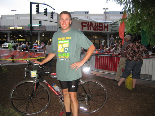
This would be my sixth Seattle to Portland bike ride. And my third that I would do in just one day. That's 204 miles in just over 12 hours. I was about to begin a very long day for my feet, legs, hands, and most of all--my bum.

The long day began when I awoke around 3:30 a.m. My gracious, loving, longsuffering, and patient wife agreed to drive me to the University of Washington's north parking lot for our dark 5:00 a.m. departure. When we neared the lot, I could see dozens of cars queued up waiting to turn right to enter the lot. We turned left, and parked at the QFC across the street along with about 20 or 30 other riders. I got dressed, checked my bike, and kissed my wife goodbye. I'd see her about seven hours later in Chehalis at mile 106.


At the parking lot, I met up with Gary R. and Jay B. We moved away from the masses lining up at the start line and Jay shared a brief devotional and then I prayed for our trip. Cary B. showed up as we moved up to the very front of the next wave and waited for the announcer to send us off. Interestingly, Jay was #9 (of about 9500 riders) since he has served as the STP startline announcer for the past half dozen or so years. Chuck Ayers, Director of Cascade Bicycle Club walked by, greeted Jay and commented on how this year's announcer wasn't as exciting as Jay. Jay smiled.


And then it was time to go. The sky was beginning to lighten as we wound our way through the streets surrounding UW and the Arboretum. As we dropped down to Lake Washington Blvd., the sun began to rise over Bellevue creating a postcard-view along our route. In these early miles, there's lots of chatter. Cyclists are talking about how excited they are, who's riding with them, what struggles they had that morning or that week to get ready, but overall, everyone is in good spirits and having fun.

At Seward Park, the ride offers its first challenge. A hard right turn that immediately goes uphill at a high grade where experienced riders call out "Gear down!" reminding newer riders to shift into a lower gear before they reach the climb.

Meet the Bandits

When we hit Renton, Gary, Jay and I pulled over at the McDonalds on Rainier to meet the rest of our group, the "bandits." The STP sold out very early this year and caught several of my friends off guard. They hadn't registered yet. And so, in cycling parlance, Kristin, Bryant, Warren, and Stoney were bandits this year: unregistered riders. Bryant's gracious, loving, longsuffering, and patient wife, Patty, had agreed to driver her minivan as their sag wagon--their support vehicle. Although, she much preferred my name for it: the Patty Wagon.


In downtown Renton, I spotted my first STP anomaly, a longboarder apparently riding his board from Seattle to Portland. We wouldn't see him again. Our ride through Kent was direct as we bypassed the first reststop at mile 24. "We're not going to the carnival today!", I shouted. The first stop at the REI headquarters is noted as a real party atmosphere that's packed with as much food on the tables as there is bikes in the parking lot. The lines for the portopotties is usually 80 or 90 people deep and its easy to burn a good 45 minutes there. If we were going to make it Portland before sundown, we needed to keep moving.

Hey Cyclist, Gotta Light?

The Puyallup hill was the second serious challenge thrown at us. It comes at mile 43 and is a mile-long climb up 72nd St. E. Bryant commented that he had just seen a rider with a cigarette hanging out of his mouth. "He must be French.", I said. Bryant's reply, "I just don't want to get passed on this hill by a guy smoking a cigarette." For the next 10 or 15 miles, we shared several jokes about cycling and smoking and spoke in our "smoker's voice." We still had energy to laugh. That would definitely change before the end of the day.


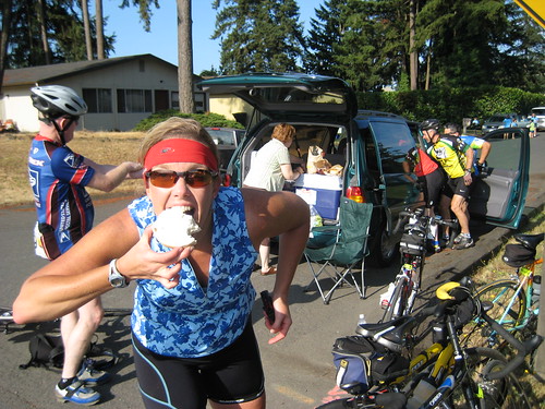
At Spanaway High School, mile 53, we found Patty's minivan parked a block away. She had the back open and it looked like a rolling supermarket. For the first time in six years riding STP, I felt unfortunate being a registered rider. The others reminded me the food was for bandits only. I ate some anyway.

After a 20 minute stop, we rolled out promising to meet Patty in a couple of hours in Tenino at mile 86. The sun was out and was bright and warm. We headed south on SR-507 past Fort Lewis and through tiny towns like Roy, McKenna, Yelm, and Rainier. Our average speed surprised me. We were cruising! I had 17.3 at one point, but I also knew that the second hundred miles were coming and they offered something we hadn't seen too much of: hills. At Tenino, we not only found Patty, but also an empty park restroom with NO LINES! We learned from Patty that traffic around the course was so bad, her average speed was just a few miles per hour faster than us. We were almost outpacing her!


After Tenino, we passed through Bucoda and then arrived in Centralia, the official STP mid-point stop. But we didn't stop. We did thoroughly enjoy the most refreshing part of the ride thus far, a series of water misters positioned just over the left side of the road. Ahhhh! We rolled right through the party taking place at Centralia College where riders had abondoned their bikes for the day, set up tents and were replacing their spent calories. It was just a few minutes before Noon. We continued a few more miles to a public pool parking lot in Chehalis where we met Patty as well as my wife Susie. We enjoyed a leisurely lunch, visited with each other, made our plans for the next stop, and began riding about 40 minutes later.

Ain't No Flat Ride

As I mentioned, the second half of the ride is where the hills begin. The STP is often incorrectly described as a flat ride. Au contraire. My GPS tells me at the end of the ride, that the elevation gain is over 6000 ft. There are no big climbs, but there are many small ones. And those add up fast. After crossing I-5, we climbed up one of those hills into Napavine and then turned toward Winlock. Near Evaline, someone ahead of us saw a Dan Henry (the painted symbols on the roadway marking the direction of travel) pointing a right turn down Old Schoolhouse Road. After making the turn, I saw about a hundred riders ahead of me making a U-turn calling out "wrong turn! wrong turn!" Seems that Dan Henry wasn't an official STP symbol and merely one left over from some other ride. You have to be a discerning Dan Henry reader on this ride.
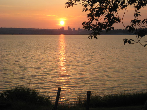

What's the Deal with My Feet?!

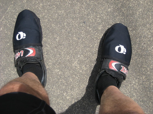
Just before Winlock, I was thinking to myself, "Man, my feet are so hot! They're burning up! What's the deal?" I looked down to discover I had never removed my toe warmers. Useful in cold weather. Completely unnecessary today. In Winlock, I told Bryant to pull over while I removed them. He called attention to my dopey move for onlookers to laugh and point. Hey, makes for better stories.

After Winlock, we cruised through Vader, hit that nice downhill, and then suffered through a few rollers and bigger hills on our way to Castle Rock, our next stop at mile 138. Both Susie and Patty were at Castle Rock High School parked and waiting for us. My speed was slowing and the day was beginning to win the fight. But more fuel, some water on my feet, and a chance to sit in a real chair prepped me for a second wind (or perhaps this was the fourth or fifth wind.) After Castle Rock, we passed the official Lexington reststop, and then biked for awhile out in rural Cowlitz County. We finally found city roads in Kelso and Longview and then turned west toward our last challenge within Washington, the Lewis & Clark Bridge. This towering bridge, overlooking the Longview lumber shipyards, crosses the Columbia River as well as the WA/OR state line.

We're in Oregon!

At mile 153 we entered Oregon at about 4:30 p.m. We had just 50 miles to go. The end was in sight, if not physically, then at least mentally. State Route 30 takes us all the way into the Portland outskirts. It's rough, mostly uphill, and boring. Fortunately, this year didn't feature the other notable attibute, a headwind. The winds were manageable this year, but soon I was eager for a change of scenery. Get me to St. Helen's so I can see something different! At mile 175, we reached St. Helen's High School for our final rendevous with the Patty Wagon. It was 6 p.m. when we left and we figured we'd reach Portland before 8.


The last 29 miles are not among the easiest. But, soon I was seeing signs reading "Portland.....10" and rejoicing. I couldn't believe I'd be finishing so early. Last year at this point, it was past 9 p.m. and getting very dark. This year, there was plenty of light left. I could see where I was riding! We hit the streets of downtown Portland just after 7 p.m. and wound our way through the city weaving toward Lloyd Center and Holladay Park. Soon, the end truly was in sight.

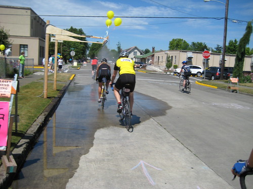
The finish line was just two blocks away. People lined both sides of the street, cheering and clapping as we entered the finish line chute. Cheering supporters lined shoulder to shoulder on the metal barricades creating a long finish line channel within Holladay Park. Adrenalin began to course as I realized I had made a personal record. I finished in just over 12 hours time. It was 7:45 p.m. I had just biked from Seattle to Portland, again, but had done it the fastest I had ever experienced. I averaged 17 miles per hour. But all of that didn't matter so much right now. What did was getting off my bike, buying a Frappuccino, and then taking the best shower ever. It had been a long day indeed.

Time: 12:10:31
Dist: 203.83
Avg: 17.0
Max: 35.9
Total Elev. Gain: 6728 ft.
Max. Elev: 473 ft.

Sunday, June 24, 2007

Tour de What a Blast


Saturday, June 23— Our adventure began the night before. Bryant, Kristin, Warren, Rick, Jim and I met at Eastside Foursquare Church, loaded our bikes and then ourselves for the drive to Castle Rock. The next day, we planned to arise early and begin our trek to the "top" of Mount St. Helen's for the Tour de Blast, a bike ride up the face of the Northwest's active volcanic peak in the Cascade mountain range. Traffic was slow and awful at times, but we reached Olympia for a fine pizza or pasta-loading dinner at Dirty Dave's Pizza and Pasta. Our accommodations in Castle Rock were spacious yet sparse. But we weren't here for entertainment. It was time for sleep. Morning would come early and we would be on our bikes for most of the next day.


Breakfast at the restaurant near the hotel filled us well. We were puzzled why one weary server alone was trying to meet the demands of booth after booth of TdB cyclists. Shortly thereafter, the patrons began filling the void by serving each other coffee.

Our starting line was Toutle Lake High School, about 10 miles from I-5 on Spirit Lake Memorial Highway and at 500 ft. above sea level. The route is an out-and-back 41 miles to Johnston Ridge Observatory, 82 miles total. The elevation gain is posted as 6,240 feet, but we calculated a bit more. There are three significant climbs. The first is Elk Rock Summit which is 3,800 ft. at mile 27. From there, we drop down to 2,530 ft. at Coldwater Creek and then begin the 6 or 7 mile climb up to Johnston Ridge at 4,200 ft. On the return trip, we climb from Coldwater Creek back up to Elk Rock followed by a long and thrilling descent that lasts forever on the return to Toutle H.S.


The weather began sunny yet cool. Last year, the temps were well into the 80s, so a few of us were prepared for heat, though the day would never get warmer than 65 it seemed. In fact, I have never dressed and undressed on a ride as much as I had this day. It went like this. Clouds are coming in, it's getting cooler. Stop the bike. Put on a jacket and gloves. Beginning the climb to Elk Rock, take off the jacket, take off the arm warmers, take off the gloves. Reach the summit. It's cold up here, put on the jacket. Ready to descend, put on the arm warmers, put on the gloves, put on the vest underneath the jacket. Descend. Stop the bike. Take off the jacket. Take off the gloves. Ride. Time to climb again. Take off the arm warmers. Unzip the vest. Reach the summit. Repeat.

In fact, at the rest stop at Elk Rock, it was cold enough that the good people staffing the stop had prepared a firepit surrounded by camp chairs. Not too many June rides feature a fire pit. It was a nice touch. But, we didn't linger too long around the flames. We had some burning of our own to do, namely the remaining 14 miles to the top of Johnston Ridge.


The descent down to Coldwater Creek was fast and refreshing after the long climb up. But, as mentioned, it was cold. We past just as many riders who were already returning from the summit and on their way back to the finish. I could tell that the descent from Johnston Ridge was going to fast and fun. But first, the climb up. This was my third year riding TdB and I was pleasantly surprised to find that this climb wasn't as hard as I remember it. That might be due to improved fitness, or it could be that I just had fashioned a memory in my head that was so painful and long that the actual experience fell short of how I recalled it. Cyclists' psychological trick #47. "Prepare for and expect the impossibly hard. Be pleasantly suprised when it's slightly easier."


At the summit, all of us—except for Rick, who had already descended—met up for a group photo and to recall the climb and comment that the food was far more plentiful than last year. Now it was time for the payoff. After all that climbing, now we get the freebie... the descent that will carry us as fast as we want for the next 7 miles. Bryant S. deserve credit for getting the most out of his descents. He clocked 50 mph that day. Crazy.


The hardest portion of the ride for me was the long, very long, climb back up to Elk Rock from Coldwater Creek. It seemed to go on forever. Not particularly steep, just long. Bryant had counted the bridges, so he had a good idea of where he was and where he still had to go. I found myself thinking "Okay, just around this corner... Crap. More climbing." (It's a thought that comes far too often during these summer rides.) Finally, I made it to Elk Rock, certain that the rest of the group was way ahead. Only Jim, who arrived right after me, and Bryant were still with me. Jim and I began the crazy descent from Elk Rock that felt like it wouldn't end. We pedaled like madmen and just kept descending. When we finally flattened out, Bryant joined us (no doubt descending at 50 mph again). The three of us formed a rotating paceline and covered the last 15 miles to the finish despite a nasty headwind. I was grateful for the teamwork and especially for two riders who cast a fairly significant "wind shadow."


Our reward for the ride was a great spaghetti feed, hot shower, and a comfortable ride back home. Our 82 miles was behind us and now we were mentally preparing for the next big ride. Tour de Blast was a blast. Afterall, it's not every day you get to ride your bike up the face of an active, steam-spewing volcano.

Dist: 84.59
Time: 6:29:59
Avg: 12.0
Max: 38.4
Total Ascent: 7,578 ft.
Max. Elev: 4,203 ft.
Riders: Bob H., Warren, Kristin, Bryant, Jim, Cary, Gary, Rick S.